
Geo-Spatial Intelligence
Another important aspect of the GEOINT process has to deal with the sensors that are incorporated by various agencies’ in order to create these geo-spatial products. The following page is going to address some of the major tools used in our modern society today, including various satellite systems and the unmanned predator drone, which is become a major vocal point of military intelligence gathering. For the most part, when trying to gather geo-spatial intelligence in hostile areas or places affected by natural disaster, it makes sense that the necessary tools would be ones that can perform these duties from a great distance away. With that being said, there is also the need for ground truth information in many scenarios that can be derived by a variety of methods, most notably the incorporation of human interaction as the reference source.
OPERATIONAL SYSTEMS
Platforms & Sensors
In order to successfully record information through the use of a sensor from a distance, the technology would need to be mounted in some sort of platform. A common misconception regarding platforms and sensors is that these words are interchangeable, meaning that a sensor and satellite mean the same thing. Unfortunately this is not the case, and hopefully the following explains the difference between the two terms. A sensor is the actual mechanism or technology that is going to record the necessary data to perform the intelligence gathering process. A platform is the vehicle that the sensor is mounted in, thus allowing it to become mobile in order to move to various locations as needed for different projects or studies being conducted. Both terms complement each other, and in order to fully take part in this process, for the most part you are going to need a platform and a sensor.
Platforms can fall into numerous categories, including some that stay within our atmosphere to record data, and others that extend out into space in order to gather as much data as possible. Having various options allows for the intelligence gathering process to take place in a variety of settings, regardless of obstacles and environments that could prevent certain platform types from being able to reach the location of interest. With that being said, one of the most popular pieces of technology falling into the platform category is the satellite system. Used widely in the field of remote sensing, as well as the geo-spatial intelligence gathering, this is a preferred system due to the scope and range it can cover. Speaking in terms of GEOINT, the satellite offers a premium service considering the use of it allows for no one to be in harms- way, as well as allowing for a wide range of data to be collected for investigative purposes, though this is primarily based on the sensor, the platform also contributes to the success of the data acquisition. Various types of sensors can be placed on a satellite system based on the information that is trying to be derived.

An Image of a Satelite Platform orbiting the Earth provided by http://wikicurios.files.wordpress.com/2011/10/cac3addarosat.jpg
Another popular piece of technology that has been incorporated as a platform is the use of airplanes. Airplanes offered a huge advantage since there creation in regards to gathering data, allowing for a more controlled approach in regards to focusing the sensors over the specified areas. As air planes have become more sophisticated over the years, their ability to reach areas of interest has also grown as well, thus allowing for a variety of geo-spatial intelligence to be gathered necessary to complete various types of investigations. This was an extremely innovative step for not only the field of intelligence gathering, but also any field looking to incorporate the use of remotely sensed data.
Dealing more with the combination of the sensor and platform, it should be noted that there are a variety of options that agencies incorporating the use of GEOINT have at their disposal. First and foremost, there are systems out there that are strictly used by the government for operations conducted around the world, regarding various types of subject matters. These systems were created by the government and can only be accessed by government officials, which typically means that the information is classified as sensitive, and cannot be distributed to the public. Another type of sensor platform system that can be employed for GEOINT purposes is the use of commercial and public outlets, considering the easy access to data. What this simply means is, sensors out there created by organizations such as NASA and the USGS are typically accessible by the public sector, also meaning that its information can be used by those wishing to incorporate that data into the efforts of their agencies mission. In regards to the purpose of GEOINT, it makes sense to have this data as a tool as well considering it could be used as a great source of reference data to support the information being gathered by the government issued systems that were being discussed earlier. Also, as anything else in life, if the data is already there, why not save time and use it. In the case of GEOINT, where in a lot of situations, the data is being derived in situations with a strict deadline, the quickest way to produce accurate data is normally the process that is implemented.
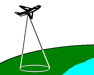
An image of an Airplane Platform provided by Source http://www.crisp.nus.edu.sg/~research/tutorial/airbrn.gif
The Predator Drone
As one of the most recent innovations in the field of intelligence gathering, it seemed appropriate to provide a summary of the Predator Drone in its own section. This piece of technology was a major success in the field of avionics for two major reasons, the first being the fact that it incorporated weapons systems and remote systems into a platform that could launch and reach locations across the world in a very short amount of time. Secondly, and more importantly, the predator drone is an unmanned aerial vehicle, thus allowing pilots to not have to be put into harm’s way when faced with acquiring data in hostile situations. Speaking in terms of the GEOINT process, the use of the predator drone has become critical in activities taking place around the world. When dealing with hostile areas that could be potentially harmful to our nation’s pilots, and not accessible or conducive to the satellite sensors, this offers a tremendously successful option to gather the necessary data. The predator drone is a tremendous leap in not only the field of avionics, but also the field of intelligence gathering, allowing our nation to stay as up to date as possible in regards to acquiring data on areas of natural disaster, or those that fall into the category of an extremely hostile area.

An image of an Unmanned Predator Drone provided by http://s.hswstatic.com/gif/predator-7.jpg
Would you like to know more?
- More information on the Predator Drone - Wikipedia
- A look at the various platforms used in Remote Sensing - Penn State
- Understanding Active vs. Passive Sensors - SEOS